Forum Replies Created
-
AuthorPosts
-
Dogwood
ParticipantHello All,
How is the air lately? I see reports of a fire in West Point that is 70% contained.
Thankssgagacabin
ParticipantWe have two different cell services. One is Verizon that works great, the other is AT & T that doesn’t work after Murphy’s area. As for a landline, we use Magic Jack. $35 a year, can’t beat that. Grandkids use walkie-talkies. lol
ndamico
Participanthi,
short of wifi calling does anyone have any tmobile service up in bigtrees or arnold?bigtreestechman
KeymasterBig wind!
Lost power around 2:30am. On batteries for as long as they last.Snider Snow and Stump
ParticipantSorry! Snider’s 209 795-2847
Thank you
Jessica SniderParticipantWe are clearing a huge area today in Dorrington. Would anyone like a full load of 8ft logs deliverd to your home? One load is about a cord. It’s fir and cedar. I know you all probably have access to wood. Just in case you didn’t we have a dump truck and can deliver for free. Adam can take it to Miller’s unless people want it delivered.
Jessica Snider 209 755-2847carlshome
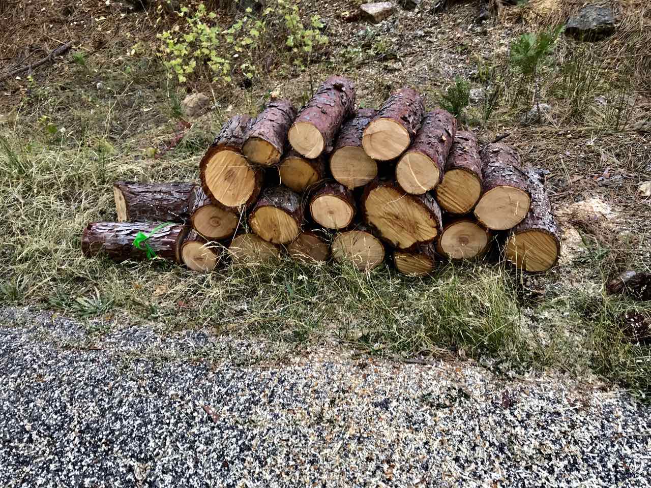
ParticipantFREE firewood at my place too. PG&E cut two cedars in early summer and I have 20+ small rounds (6-12 inches in diameter) at the end of my driveway at 2301 Indian Rock. First come first serve. See attached photo.
Attachments:
caleach
ParticipantWay to go Joe!
Steve
cmon4day
ParticipantA loop that I’ve done before is to start at the BV gas station and head up to the lake. Near the dam, cross the street you’ll find a trail that takes you up to the big turn where they park the snow cats. Then proceed up the dirt road to the top of Koala and continue up to the top of Bear. From the top of Bear, go down West World and you find along the dirt road and find the mid slope trail that takes you over to Corral Ridge. Continue on and depending on how far you want to go you can take a left on 7N35 which takes you back to CA-4 via Corral Gulch. Or, if you want to keep going, don’t take the left and follow the trail to Bear Trap Basin. Which loops around and comes back to 7N35 for your exit.
Attached is a crude .gpx file I made showing the route. Note, there are some extraneous lines so be careful using this solely as your navigation.
ParticipantFree, un split firewood art theft of the drive way at 1461 Karock, off Pawnee. First come, first served.
michelle s
ParticipantWell, there’s the Wheeler Lake trail if you can find the other way back. Go in at Woodchuck Basin, takes you up a summit near Mt Reba, drop down the other side and you get to Wheeler Lake, which is lovely. Most people go back the same way (~ 7 mi RT), but I’ve heard there is another trail up and over to the northeast, and I think we saw the traces of it from the summit. This could make it a loop, probably about the right distance. However, even the main trail was somewhat damaged over the heavy winter, so I suspect the “northeast passage” is even more difficult this year.
tortuga
ParticipantWe did a loop from Union to Rock Lake, trail lost through tree fall to end up up at Duck lake and back to Union. We got ~12 miles.
I see Stanislaus Mdw to Bull Run and Heiser to Mosquito and back to Stanislaus Mdw for 8-10 miles.
With a car shuttle we could get the whole of ART.
What other ~8-12 mile hikes are there that are NOT out-n-back? Prefer loop trails but shuttling could work sometimes.
I don’t see anything promising from Sourgrass nor Sand Flat/Wolfboro, wouldn’t it be nice if the two were connected by a river-side trail the whole way!
ParticipantJOe,
Thank you! Love it! Great job!ParticipantAwesome job! This is really useful. Now I will have to stop by every day!!
Sierrashoo
ParticipantI used Defy Extreme on my redwood deck. First the cleaner/brightner, then the sealer. Very easy to apply and clean up. Deck looks great and very water repellent now.
-
AuthorPosts